9 Apr 2011
Geoslideshow
I’ve been slowly pursuing the Ghostsigns Worldwide idea and, in the process, came across a new web application being developed.
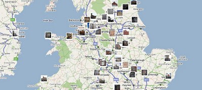
It’s called Geoslideshow and, in response to my suggestion, they’ve cracked the code to generate a map of all geotagged photos in a Flickr group. Click here for the application of this to the Ghostsigns group. It’s a great result and has opened up lots of further possibilities – big thanks to Geoslideshow. More to follow I hope…


